You are here

Climate

Across the Globe, Millions Join Biggest Climate Protest Ever


Greta Thunberg addresses thousands of demonstrators in New York. Photograph: Lucas Jackson/Reuters

Young and old alike took to the streets in an estimated 185 countries to demand action

theguardian.com - by Sandra Laville and Jonathan Watts - September 20, 2019

Millions of people demonstrated across the world yesterday demanding urgent action to tackle global heating, as they united across timezones and cultures to take part in the biggest climate protest in history.

In an explosion of the youth movement started by the Swedish school striker Greta Thunberg just over 12 months ago, people protested from the Pacific islands, through Australia, across-south east Asia and Africa into Europe and onwards to the Americas . . .

 . . . Trade unions representing hundreds of millions of people around the world mobilised in support, employees left their workplaces, doctors and nurses marched and workers at firms like Amazon, Google and Facebook walked out to join the climate strikes . . . 

Country / Region Tags: 
General Topic Tags: 
Problem, Solution, SitRep, or ?: 

National Storm Surge Hazard Maps

https://noaa.maps.arcgis.com/apps/MapSeries/index.html?appid=d9ed7904dbec441a9c4dd7b277935fad&entry=1

This national depiction of storm surge flooding vulnerability helps people living in hurricane-prone coastal areas along the U.S. East and Gulf Coasts, Puerto Rico, U.S. Virgin Islands (USVI), Hawaii, and Hispaniola to evaluate their risk to the storm surge hazard. These maps make it clear that storm surge is not just a beachfront problem, with the risk of storm surge extending many miles inland from the immediate coastline in some areas. If you discover via these maps that you live in an area vulnerable to storm surge, find out today if you live in a hurricane storm surge evacuation zone as prescribed by your local emergency management agency. If you do live in such an evacuation zone, decide today where you will go and how you will get there, if and when you're instructed by your emergency manager to evacuate. If you don't live in one of those evacuation zones, then perhaps you can identify someone you care about who does live in an evacuation zone, and you could plan in advance to be their inland evacuation destination – if you live in a structure that is safe from the wind and outside of flood-prone areas.

National Hurricane Center - National Storm Surge Hazard Maps - Version 2
https://www.nhc.noaa.gov/nationalsurge/

Country / Region Tags: 
Problem, Solution, SitRep, or ?: 

Drought in Puerto Rico


drought.gov

Drought in Puerto Rico from 2000 - 2019

The U.S. Drought Monitor started in 2000. Since 2000, the longest duration of drought (D1-D4) in Puerto Rico lasted 80 weeks beginning on May 5, 2015 and ending on November 8, 2016. The most intense period of drought occurred the week of September 1, 2015 where D4 affected 24.89% of Puerto Rico land.

The U.S. Drought Monitor (USDM) is a map that shows the location and intensity of drought across the country. The data is updated each Tuesday and released on Thursday.

CLICK HERE - Drought in Puerto Rico - https://www.drought.gov/drought/states/puerto-rico


Country / Region Tags: 
Problem, Solution, SitRep, or ?: 

Hurricanes, Droughts, and Wildfires: How Biopharma is Girding for Climate Change


A runner tries to navigate a flooded section of sidewalk underneath the Longfellow Bridge in Cambridge, Mass.  Jessica Rinaldi/The Boston Globe

statnews.com - by Kate Sheridan - February 15, 2019

. . . the potential risks of climate change — and the attendant increase in natural disasters — stand to outstrip any … incremental gains, as the companies described in recent risk assessment reports to the British nonprofit CDP.

Hurricanes and superstorms, power outages and flooding all threaten manufacturing facilities and research sites, particularly when animals are involved. Droughts, too, threaten critical water supplies. Forest fires, even if remote from a given plant or research facility, bring smoke and air pollution that can similarly disrupt the day-to-day work for drug makers and their supply chain . . .

. . . STAT surveyed the risk assessment plans for more than a dozen major pharmaceutical companies and spoke with officials at labs that survived extreme weather events and others who are planning to avoid their repercussions. All emphasized that the risks are already real — and underscored how hard the industry is working to prepare to meet the challenge.

Country / Region Tags: 
Problem, Solution, SitRep, or ?: 

Unusually Warm Sea Water Boosted 2017's Catastrophic Hurricane Season


A Sept. 7, 2017, satellite image from NOAA shows the eye of Hurricane Irma, left, just north of the island of Hispaniola, with Hurricane Jose, right, in the Atlantic Ocean. Six major hurricanes formed in the Atlantic in 2017, including Harvey, Irma and Maria.  (Photo: AP)

CLICK HERE - STUDY - Dominant effect of relative tropical Atlantic warming on major hurricane occurrence

usatoday.com - by Doyle Rice - September 27, 2018

The catastrophic 2017 hurricane season – which included such monsters as Harvey, Irma and Maria – was fueled in part by unusually warm ocean water, a new study suggests.

And because of human-caused global warming, the study said similar favorable conditions for fierce hurricanes will be present in the years and decades to come . . .

 . . . "We show that the increase in 2017 major hurricanes was not primarily caused by La Niña conditions in the Pacific Ocean, but mainly by pronounced warm sea surface conditions in the tropical North Atlantic," the study said.

Country / Region Tags: 
General Topic Tags: 
Problem, Solution, SitRep, or ?: 

How Storms, Missteps and an Ailing Grid Left Puerto Rico in the Dark


A transmission tower and downed lines in the mountainous terrain of eastern Puerto Rico. Workers from the island and throughout the United States have worked to restore power after Hurricanes Irma and Maria last September.

It took months to restore electricity in Puerto Rico after hurricanes dealt a one-two punch. Many homes are still without power, and the system’s future is far from certain.

nytimes.com - by JAMES GLANZ and FRANCES ROBLES - Photographs by TODD HEISLER - May 6, 2018

 . . . After Maria and the hurricane that preceded it, called Irma, Puerto Rico all but slipped from the modern era . . .

 . . . an examination of the power grid’s reconstruction — based on a review of hundreds of documents and interviews with dozens of public officials, utility experts and citizens across the island — shows how a series of decisions by federal and Puerto Rican authorities together sent the effort reeling on a course that would take months to correct. The human and economic damage wrought by all that time without power may be irreparable.

Country / Region Tags: 
Problem, Solution, SitRep, or ?: 

NATIONAL HURRICANE CENTER TROPICAL CYCLONE REPORT - HURRICANE MARIA (AL152017) 16–30 September 2017

CLICK HERE - NATIONAL HURRICANE CENTER TROPICAL CYCLONE REPORT - HURRICANE MARIA (AL152017) - 16–30 September 2017 - Richard J. Pasch, Andrew B. Penny, and Robbie Berg National Hurricane Center - 10 April 2018 (48 page .PDF report)

nhc.noaa.gov

Maria was a very severe Cape Verde Hurricane that ravaged the island of Dominica at category 5 (on the Saffir-Simpson Hurricane Wind Scale) intensity, and later devastated Puerto Rico as a high-end category 4 hurricane. It also inflicted serious damage on some of the other islands of the northeastern Caribbean Sea. Maria is the third costliest hurricane in United States history.

ALSO SEE ADDITIONAL REPORTS HERE - National Hurricane Center - 2017 Atlantic Hurricane Season


Country / Region Tags: 
Problem, Solution, SitRep, or ?: 

Are We Ready for the Deadly Heat Waves of the Future?


HEAT ISLANDS  Heat claims more lives than floods, hurricanes and other weather-related disasters. How will cities cope as temperatures rise?  ULTRAFORMA/ISTOCKPHOTO

When days and nights get too hot, city dwellers are the first to run into trouble

sciencenews.org - by AIMEE CUNNINGHAM - April 3, 2018

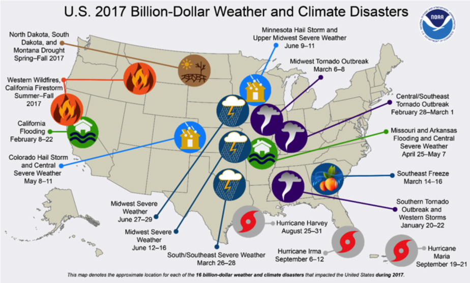
Since 1986, the first year the National Weather Service reported data on heat-related deaths, more people in the United States have died from heat (3,979) than from any other weather-related disaster — more than floods (2,599), tornadoes (2,116) or hurricanes (1,391). Heat’s victim counts would be even higher, but unless the deceased are found with a fatal body temperature or in a hot room, the fact that heat might have been the cause is often left off of the death certificate, says Jonathan Patz, director of the Global Health Institute at the University of Wisconsin–Madison.

As greenhouse gases accumulate in the atmosphere, heat’s toll is expected to rise. Temperatures will probably keep smashing records as carbon dioxide, methane and other gases continue warming the planet. Heat waves (unusually hot weather lasting two or more days) will probably be longer, hotter and more frequent in the future.

Country / Region Tags: 
General Topic Tags: 
Problem, Solution, SitRep, or ?: 

Scalable Water Management Solutions for Developed & Developing Cities


Cape Town, South Africa

meetingoftheminds.org - by Manohar Patole - April 3, 2018

The growth of urban settlements is subject to a range of factors influenced by demographic, economic, political, environmental, cultural, and social factors. Weather variability, or climate change, has recently risen up this list. These two factors: climate change and urban population growth, are dramatically affecting urban water management. On one hand, growing populations increase urban water demand and on the other, climate change has increased water variability (volume, distribution, timing and quality) . . . 

 . . . How will cities adapt? Reframe. Develop new responses.

(CLICK HERE - READ COMPLETE ARTICLE)


Country / Region Tags: 
Problem, Solution, SitRep, or ?: 

2017 U.S. billion-dollar weather and climate disasters: a historic year in context


This map depicts the general location of the sixteen weather and climate disasters assessed to cause at least one billion dollars in direct damages during 2017.

climate.gov - by Adam B. Smith - January 8, 2018

NOAA’s National Centers for Environmental Information (NCEI) tracks U.S. weather and climate events that have great economic and societal impacts (www.ncdc.noaa.gov/billions). Since 1980, the U.S. has sustained 219 weather and climate disasters where the overall damage costs reached or exceeded $1 billion (including adjustments based on the Consumer Price Index, as of December 2017). The cumulative costs for these 219 events exceed $1.5 trillion.

During 2017, the U.S. experienced a historic year of weather and climate disasters.  In total, the U.S. was impacted by 16 separate billion-dollar disaster events including: three tropical cyclones, eight severe storms, two inland floods, a crop freeze, drought and wildfire.

(READ COMPLETE ARTICLE)

Country / Region Tags: 
General Topic Tags: 
Problem, Solution, SitRep, or ?: 

Pages

Subscribe to Climate
howdy folks